


ROAD AND PUBLIC TRANSPORT
[ ROAD AND PUBLIC TRANSPORT ] [ SCHOOLS IN NELSON MANDELA BAY ] [ REAL ESTATE AND ACCOMMODATION ] [ ESSENTIAL INFORMATION ] [ WEATHER ] [ LEISURE OFFERINGS ] [ MUNICIPAL SERVICES ]
Nelson Mandela Bay’s well-equipped airport, two harbours, highways and roads link Southern Africa, and the Eastern Cape in particular, with other major national and international destinations.
The centrally situated Port Elizabeth Airport is easily accessible from all parts of the city. A number of flights are available that connect Nelson Mandela Bay with domestic and international destinations, through the Durban, OR Tambo and Cape Town International Airports every day. The Airport is serviced with regular flights by South African Airways (SAA) as well as certain local and national airlines including SAA - SA Express and British Airways/Comair and Kulula as well as other airlines. Scenic helicopter flips, tours and charters are available to tourists who want to get a bird’s eye view of the Bay, the coastline and surrounding areas.
Taxis, hotel transport and plenty of car hire options are available from the Airport, while shuttle services offer a convenient mode of transport in and around the city, as well as in the surrounding areas. Taxis offer a reliable, convenient, courteous and quick service. As a rule, taxis throughout South African cities do not cruise: you are advised to telephone a taxi for service. Municipal buses, operating as a service to especially people living within Nelson Mandel Bay, travel to all parts of the city and residential areas. Uber and Taxify are also available in the city.
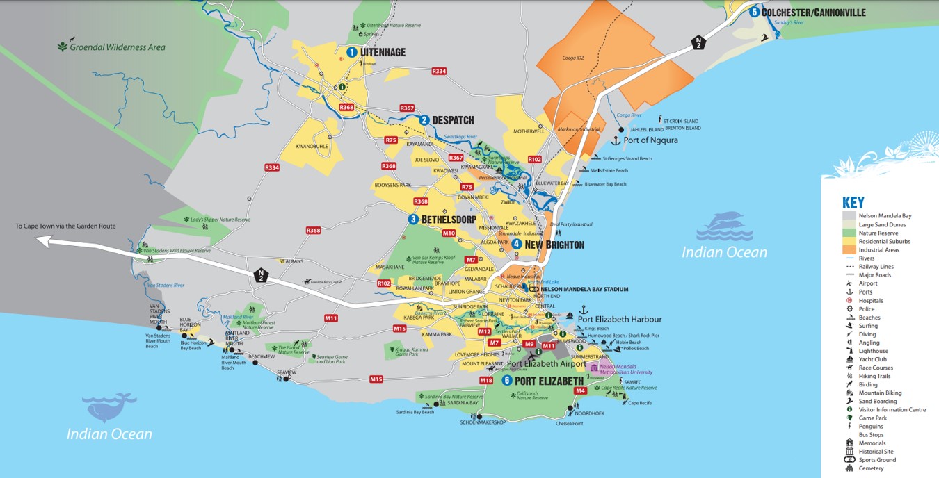
The N2 enters Port Elizabeth from the west before veering north when it reaches the coastline of Algoa Bay. The R102 roughly parallels the N2, but runs further south, into the city centre before turning north. The R75 leaves the R102 as it begins leaving the city centre from the north, and heads in a roughly north-west direction towards Uitenhage. It then veers north skirting the town centre and continuing on towards Graaff-Reinet.
Of the five three-digit R roads in the city, one, the R333 seems to be no longer in use, with the road instead described as the M6. The R334 starts just north of the city, leaving the N2 and heading in a westerly direction. It runs through the northern parts of Motherwell township before passing through the centre of Uitenhage and then exiting the town in a south-westerly direction, returning to the N2. The R335 leaves the N2 at the level of the northern suburb of St. George's Strand. It initially heads west-north-west through Motherwell, before veering north, crossing the R334 and heading towards Addo, Eastern Cape. The R367 seems to have partly been renumbered the M19. In full, it branches from the R102 at Swartkops, a suburb in the north-east of Port Elizabeth, and heads in a roughly west-north-west direction towards Uitenhage, crossing the R75 and ending in the city centre at the R334. The R368 also seems to be phased out, and branches from the R75 in the suburb of Algoa Park and parallels its course, except that it continues to the city centre, likewise ending at the R334.


 Please wait!